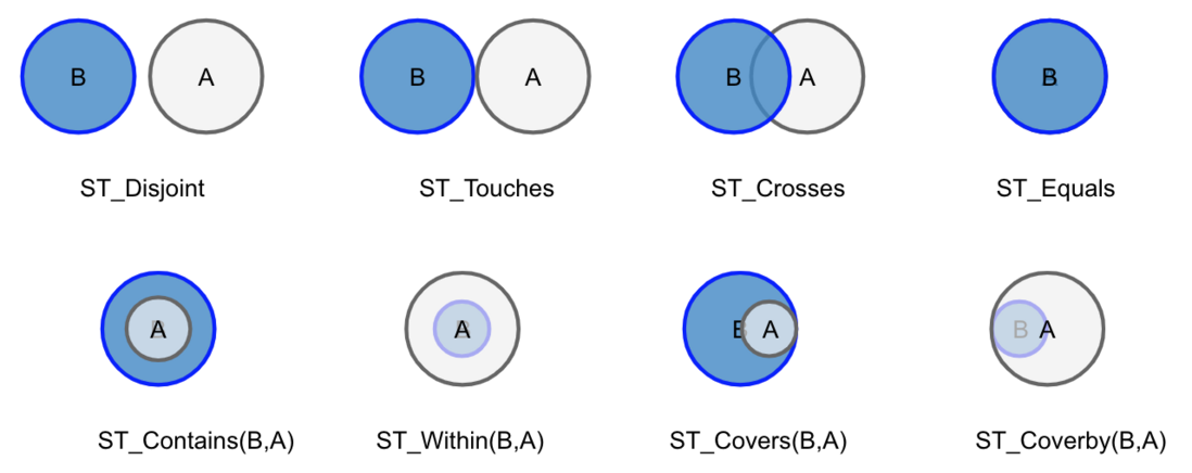
Complex geometries / trajectories: point, polygon, linestring, multi-point, multi-polygon, multi-linestring, GeometryCollection
| postgis | esri udf | sf | geospark | function | definition |
|---|---|---|---|---|---|
| partial | partial | yes | no | st_cast | Convert the geometry type from one to another |
| yes | yes | yes | yes | ST_GeomFromText | Return a specified ST_Geometry value from Well-Known Text representation (WKT). |
| yes | yes | no | no | ST_MakeBox2D | Creates a BOX2D defined by the given point geometries. |
| yes | yes | yes | yes | ST_Point | Returns an ST_Point with the given coordinate values. OGC alias for ST_MakePoint. |
| yes | no | no | no | ST_PointFromGeoHash | Return a point from a GeoHash string. |
| yes | yes | yes | yes | ST_Polygon | Returns a polygon built from the specified linestring and SRID. |
| yes | yes | yes | yes | ST_Transform | Coordinate Reference System / Spatial Reference System Transformation: for exmaple, from WGS84 (EPSG:4326, degree-based), to EPSG:3857 (meter-based) |
CSV, TSV, WKT, WKB, GeoJSON, NASA NetCDF/HDF, Shapefile (.shp, .shx, .dbf)
range query, range join query, distance join query, K Nearest Neighbor query
R-Tree, Quad-Tree
KDB-Tree, Quad-Tree, R-Tree, Voronoi diagram, Hilbert curve, Uniform grids
postgis|esri udf|sf|geospark|function| definition yes|yes|yes|yes|ST_Length| calculate line length yes|yes|yes|yes|ST_Area| calculate polygon area
ST_Distance ST_ConvexHull ST_Envelope ST_Centroid ST_PrecisionReduce ST_IsSimple ST_Buffer ST_AsText
