Skip to content

Holden-F/lab_5

Folders and files

NameName
Last commit message
Last commit date

Latest commit


History

15 Commits


Repository files navigation

Computer Vision in Remote Sensing

Coastal erosion and shoreline change detection

Computer Vision can use change detection on coastlines all around the world which is extremely important with storms and natural disasters becoming worse due to climate change. With this computer vision, we can detect what is changing the fastest and make a plan to mitigate such things.
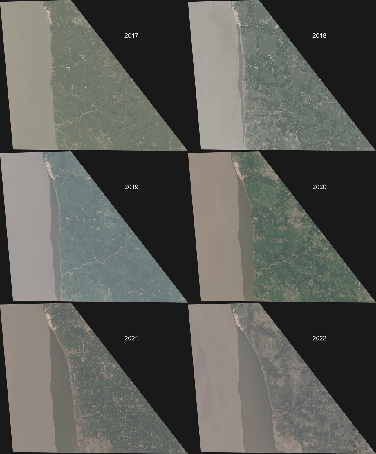
A gif of the coastline of Bangladesh Eroding.
Gif of Bangladesh Coastline erosion sourced from Lacaille 2022.

Using Satellite data would be helpful for the global scale, but UAV data is better for small scale and high resolution data. The better the resolution, the better the computer is at detecting changes.

According to students at Harvard, the artificial neural network maps the shoreline change better than both k-nearest neighbors and support vector machine in the world of machine learning.

Sources

Chapapría, V. E., Peris, J. S., & González-Escrivá, J. A. (2022). Coastal Monitoring Using Unmanned Aerial Vehicles (UAVs) for the Management of the Spanish Mediterranean Coast: The Case of Almenara-Sagunto. International Journal of Environmental Research and Public Health, 19(9), 5457. MDPI AG.

Lacaille, K., Shah, M. (2022, August 04). Eroding Coastlines: A GeoSpatial and Computer Vision Analysis. Planet Developers Blog. https://developers.planet.com/blog/2022/Aug/04/eroding-coastlines-a-geospatial-and-computer-vision-analysis/

Kumar, L., Afzal, M.S. & Afzal, M.M. Mapping shoreline change using machine learning: a case study from the eastern Indian coast. Acta Geophys. 68, 1127–1143 (2020). https://doi.org/10.1007/s11600-020-00454-9

Papakonstantinou, A., Topouzelis, K., & Pavlogeorgatos, G. (2016). Coastline Zones Identification and 3D Coastal Mapping Using UAV Spatial Data. ISPRS International Journal of Geo-Information, 5(6), 75. MDPI AG.